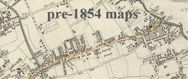
These maps accessed via oldmapsonline.org, from David Rumsey Map Collection and British Library Online Gallery.
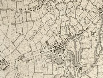
1746 An Exact Survey of the Citys of London, Westminster, ye Borough of Southwark, and the Country near Ten Miles – John Rocque. The named road, Bearbinder Lane, north of Bow, south of Old Ford, bends south to meet the main road and will later become Coburn Road. Mornington Road, yet to be built, would be somewhere south of the letter B of BOW
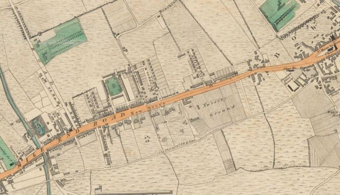
1830 – Greenwood’s Map (Harvard University) is one of the clearest, showing the nursery ground that was occupied by Mile End Nursery, extending south of the Mile End Road to a footpath which forms Hamlets Way and Archibald Street. A strip of nursery land extends south of the path. Alfred Street is an early development north of Mile End Road, with Harley Place shown at the junction.
1836 – Society for the diffusion of useful knowledge – London environs, pub. Chapman and Hall (David Rumsey Map Collection)

The land where Mornington Road would be built is marked out as ‘Nursery Ground’.
1843 – Society for the diffusion of useful knowledge – London environs, pub. Chapman and Hall (David Rumsey Map Collection)

Opposite Alfred Street is a road called “Oliver’s Grove”, and Harley Place is now on the south side of Bow Road. There hasn’t been all that much development along the Bow Road since the 1836 map – just the appearance of Harley Street. From this map it appears that the plot upon which Mornington Road would be built was part of Harley Place.
In Daniel R Bolt’sList of Streets, Places and Subsidiary Names in the Borough of Poplar (Metropolitan Borough of Poplar 1938), and M Ellistons A Topography of Tower Hamlets, Oliver’s Grove is recorded as the predecessor of Wellington Road – and it may be so. But all the maps show it precisely opposite Alfred Street, which is not where Wellington Road is sited. The maps would suggest that houses on the east side of Wellington Road were built on the site of Oliver’s Grove, and Wellington Road built just to the west of Oliver’s Grove – but so far I have found no other evidence to support such a view.
The 1852 Post Office Directory map is the last I can find showing how things were a few years before Mornington Road was laid out in 1855.

The new railway, the London & Blackwall Extension, as it crosses ‘Foot Path to Bow’ more or less marks the point to the rear of 21 – 28 Mornington Grove, the railway bridge junction between Eleanor Street, Tidworth Road and Archibald Street. Much of The Foot Path to Bow, shown in some form on all the above maps, is still traceable today as Hamlets Way, Archibald Street, over the footbridge, Arnold Road, across Campbell Road, Trevithic Way, along the footpath at the back of St Agnes Primary School to Stroudly Walk and Bromley High Street)
In the next Post Office Directory map, 1859, Harley Place and Oliver’s Grove will have disappeared; Wellington Road and Mornington Road are in place.
